One of the first things I noticed upon moving to Los Angeles was
the presence of a huge national forest less than fifteen miles from
where I lived. Being the sort who enjoys exploring backroads and remote
locations, I drove up California Rt. 2--also known as The Angeles
Crest Highway--and instantly fell in love with a terrain completely
unavailable to me during my years on the East Coast. Since then I've
traveled all over the mountain-and-desert West, most often with camera
happily in hand.
Scroll
below for a random collection of shots from 1993-2001, or check out
the newly updated sections marked off by a series of friendly asterisks.
*
* * * *
Sure,
it's got a lot of text, but the tale of my June,
2002 hike of Mt. Whitney was told in pictures as well--51 in all.
Scroll through for the choice shots, most of which are in Part 2.
But start from the beginning, won't you?
*
* * * *
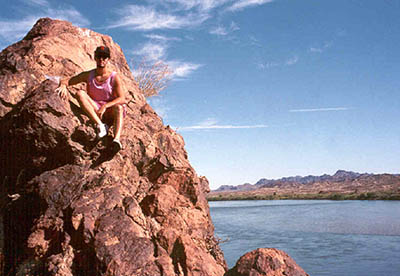
It can now be revealed that Moosenet CEO Scott Chatfield's favorite
vacation spot is the Picacho State Recreation Area, located on the
Colorado River about twenty miles north of Yuma, AZ. I accompanied
him and his lovely wife on this occasion in 1995. They say you can't
get there without a four-wheel drive vehicle, and for the most part
they're right, but I forced my Eagle Summit Wagon into duty anyway
and arrived with minimal damage.
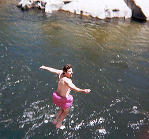
Kids, don't try this at home--a 60-70 foot (at least) jump from a
rocky cliff into the Kern River near Lake Isabella, CA in August of
1999. You could count several seconds before hitting the water. I
did it three times, enjoying the billowing sensation of my pink bathing
suit more with each jump.
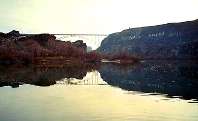
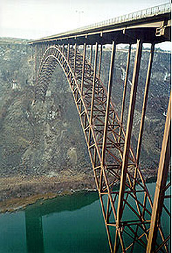
Centennial Waterfront Park in Twin Falls, ID, December of 2000. Also
known as Snake River Canyon, site of Evel Knievel's ill-fated jump
attempt back in the seventies. The first shot is from canyon ground
level, while the second is from a ledge halfway up the canyon. The
bridge is even longer than it looks. The full pictures-and-text story
of this northwestern excursion is told in Act 39 of The Life Of Bryan,
"Big
Sky I".
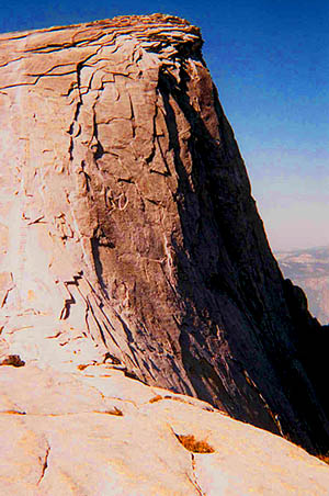
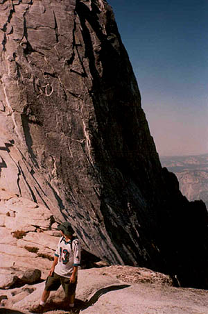
This is what awaits those who dare to hike Half Dome in Yosemite National
Park: a crazy-steep rockface ascent with only a makeshift cables-and-woodblocks
"ladder" to assist them in reaching the summit. The picture on the
left is deceiving in terms of scale. See the tiny strings heading
vertically up the left side of the rock? That's the "ladder", known
to Half Dome vets as "the cables". Each one of those tiny horizontal
lines is approximately eight feet apart height-wise. You do the math.
The picture on the right offers a more realistic view of what it really
felt like. I did indeed conquer the beast in early October of 1999,
but I almost didn't make it down. Act 34 of The L.O.B.--"Over
The Hills and Far Away"-- tells the story in excruciating detail,
and is a must-read for anyone crazy enough to consider doing this.

